Bottom Line:
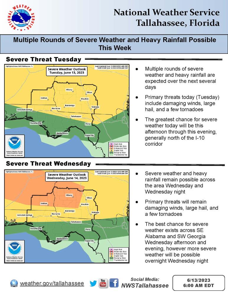
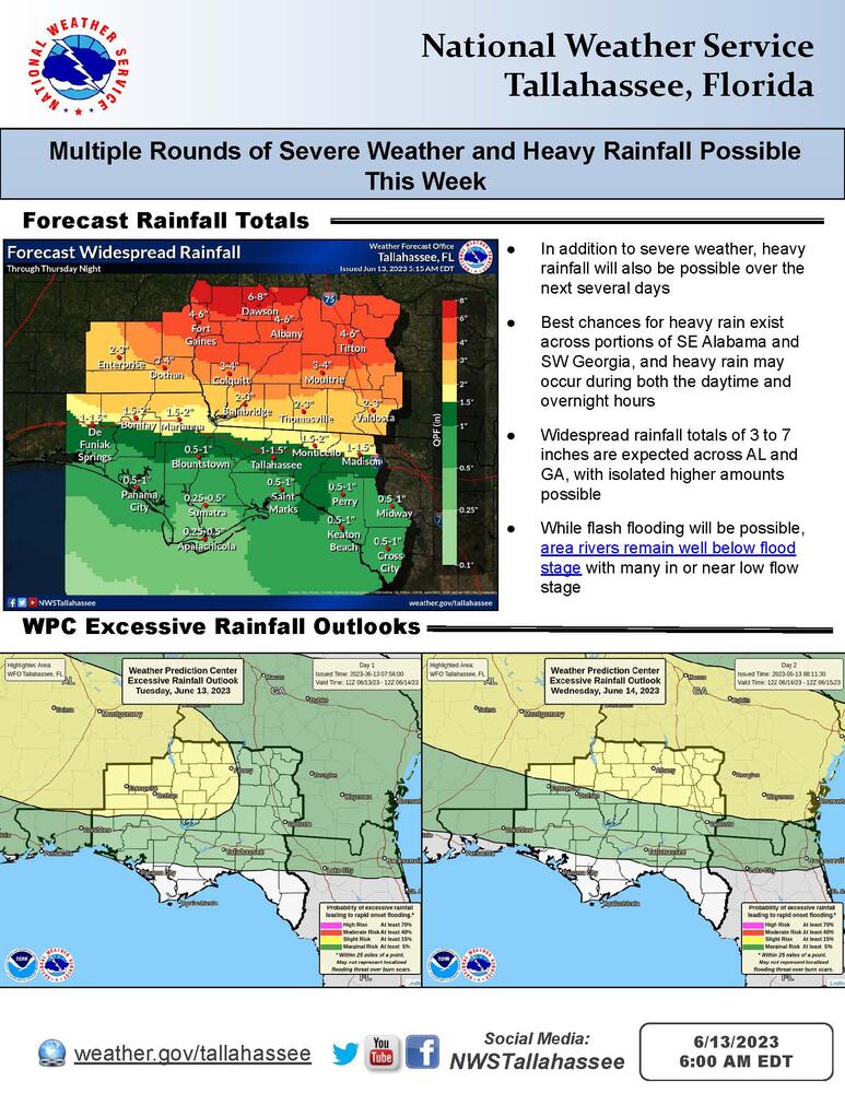
Multiple rounds of severe weather and heavy rainfall are expected across the area over the next several days. The primary hazards include damaging winds, large hail, a few tornadoes, and flash flooding. There is a slight risk for severe weather today, and an enhanced risk for severe weather Wednesday.

Overview:
An active weather pattern is expected over the upcoming week or so with several rounds of severe thunderstorms and heavy rainfall expected over the next several days. Scattered to widespread showers and thunderstorms are expected across the area during the afternoon and evening hours each day, with additional thunderstorms and heavy rainfall possible during the overnight and early morning hours. Areas generally north of I-10 are in a Slight Risk (level 2 of 5) of severe weather today. Portions of SE Alabama and SW Georgia have also been upgraded to an Enhanced Risk (level 3 of 5) of severe weather for Wednesday afternoon and evening. Both today and Wednesday the primary threats are damaging winds, large hail, a few tornadoes, and heavy rainfall.


